Wendover Woods Regional event and SCOL4
Level C
10th November 2019
Entries
Directions / Parking
From the B4009 take the turning signed Wendover Woods. Continue on this road past the Wendover Woods entrance up the hill and parking will be on the right side marked with orienteering signs.
UPDATE ON THE STATE OF THE CAR PARK FIELD – 4PM ON SATURDAY
After recent rain, the field is looking very wet, and more rain is forecast for tonight. However we are confident of getting you all into and out of the field. But please bear the following in mind.
As you come through the gate, head towards the set of ruts on the left side. This route may look tricky, as it takes you through a large puddle just after entering the field, but we know this is the best route. The ruts are compacted down to hard ground, so your wheels will be on a firm surface.
As you are driving in a set of wheel tracks, vehicles with very low ground clearance may have a problem. It will be fine for 99% of vehicles, but low slung sports cars are not advised. So leave the Elise or the Boxster at home, and cadge a lift from your mate with the X5.
Please be gentle with the throttle and use a high gear to minimise wheel spin. And be ready to lend a hand to assist any other drivers if they get stuck.
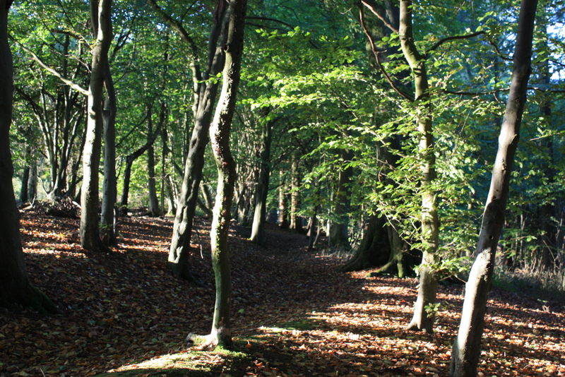
Terrain Description
Fast runnable woodland, a mixture of typical Chiltern forest and thicker areas of managed plantation. The area is characterised by the wide re-entrant between two spurs with steep slopes and a good path network.
The Map
Map updated July 2019 (Jim Prowting, TVOC); scale 1:10000, ISOM 2017, A3 printed on waterproof paper.
Courses
Brown: 8.0 km, 405 m climb
Blue: 7.2 km, 340 m climb
Green: 4.6 km, 195 m climb
Short Green: 3.8 km, 105 m climb
Light Green: 3.7 km, 80 m climb
Orange: 2.9 km, 110 m climb
Yellow: 1.8 km, 80 m climb
White: 1.4 km, 40 m climb
(Lengths updated 4/11/2019)
Start Times
9:15 – 11:45: Registration, SIAC hire/collection and enquiries open
10:00 – 12:00: Starts
14:00: Courses close
How To Enter
Pre-enter via Fabian4 has now closed. However we do have a good number of maps available on all courses, so do come along and enter on the day.
Just print off the entry form at the top of this page, fill it in, and bring it to the Registration tent, ideally with the exact money.
Entry Cost
Pre-Entries and on the day (subject to map availability):
Seniors £16 (£14 for British Orienteering members); Juniors £5
Seniors entering Orange, Yellow or White courses: £8
Pairs and groups going round together: Senior rate + £1 for each additional map
(If pre-entering as a pair or group, just enter once with one name; for example, you could use
– Forename Team Surname Jones, displays as Team Jones
– Forename John Surname Smith+2, displays as John Smith+2
– Forename Family Surname Smith. displays as Family Smith.
And you cannot order an extra map when you pre-enter, but we can sort that out for you on the day.)
Hire of a timing chip (SIAC contactless card) £2.00 for seniors & juniors
Parking: Free
Facilities
Tom’s Burgers, Toilets
Officials
Organiser: Adam Poole - TVOC email organiserPlanner: Chris Poole - RAFO
Controller: Geoff Ellis - BOK / Neville Baker - TVOC